Finally cracked the 50 mile mark on my midweek ride. I planned the route on bike route toaster and almost 80% was familiar ground. While the roads were in perfect slightly tacky, but fast condition, the few miles of trail I rode at the beginning were a bad idea. They were a soggy snowy mess. This made for extremely slow going and wasted a lot of power. Once on the roads things improved and flowed along nicely.
The two new segments along this ride (at least they were new to me) included Crane Hollow Drive, and the section from Lagerman Reservoir to Oxford Road. Crane Hollow was easily the highlight of the route. It was exceedingly quiet and serene and filled with beautiful cottonwoods. The second new portion threw me for a minor loop when I encountered road closed signs and a locked gate. I'm not sure why this connector is closed to traffic, but it's open to bikes and foot travel. Overall this was a good ride. Given the 12 inches of snow that came the night after this ride, I'm not sure when I'll get out again. Fortunately the next few days are sunny and should warm up.
Friday, December 23, 2011
Sunday, December 18, 2011
Creekside Lite
The Creekside Dirty Century is one of few gravel
grinders in Colorado. From what I’ve gathered the Century is hosted by
Creekside Bikes in Parker, and has been run in ’09, ’10, and ’11. There are few
photos on the event site and it seems that it’s pretty low key. Here’s the
original route map courtesy of Colorado Dirt Road Randonneur. The route begins and ends on the Cherry Creek Trail which I
elected to skip to do a bit shorter route.
 |
| The old dam at Castlewood Canyon |

After leaving the canyon the route winds around through back
roads eventually passing through Larkspur at about 20 miles. I didn’t take the
opportunity, but Larkspur offers several options for refueling. The Larkspur Pizzeria and Café might not be a
bad option if you choose a route that begins and ends here.

After Larkspur the route misses any options for stores, but
continues to pass through some amazing and scenic landscape. This is one of the
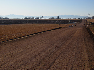
best gravel routes I’ve ridden on the Front Range to date. The roads were in
great shape. Several sections of washboard and pure loose gravel peppered the
route, but fortunately they didn’t last long. Most of the surface (at this time) was light
gravel on hardpack dirt.
The course had very few flat sections. Overall the course
was filled with rolling hills that provided about 4200 feet of elevation gain.
There are few treed sections of the route leaving sweeping scenic vistas
including quite a few old barns. Of course, the ride would be quite different story
on a windy day.

 |
| The washboard and rollers are both apparent here. |
Thursday, December 15, 2011
Commitment
I'm just gonna toss this out there. I'm been listing races and waiting for dates to finalize. There are a ton or rides and races I'd like to do, but nothing was really inspiring in the sort of scary "O crap this is a big deal I better take this seriously" sort of way. Well, This is a big deal, and I do need to get my but in gear to be ready for this one.

The High Cascades 100 was a big deal and seemed like an appropriate way to cap my first calendar year on a bike - 1 year 100 miles. The DK 200 won't come right at the two year mark but it will be the main event this year - everything else is gravy. Now it's time to log the miles, dial in the gear, the nutrition, and make some bribes for a support crew.
The High Cascades 100 was a big deal and seemed like an appropriate way to cap my first calendar year on a bike - 1 year 100 miles. The DK 200 won't come right at the two year mark but it will be the main event this year - everything else is gravy. Now it's time to log the miles, dial in the gear, the nutrition, and make some bribes for a support crew.
Monday, December 12, 2011
Toasty Toes: Shimano SH-MW81 - Review
Sometimes the gear you use can lead a ride to be a miserable sufferfest instead of a cherished memory.
I love riding, but sometimes I get cold feet. Literally. On the Double Roubaix I wore a pair of Pearl Izumi Barrier GTX boots. They’re great shoes, but they don’t fit me. Like most cycling shoes they are too narrow for my Fred Flintstone feet so I ended up with numb toes 1/2 way through the ride. I got lucky with my first pair of Bontrager RXLs – they actually fit. I didn’t even try anything else on. There was a 50% off sale on all shoes and they were the only ones in my size (43). I wasn't looking for a carbon soled race shoe, but I ended up with one. Since then, I’ve tried Sidi, Specialized, Mavic and several others to no avail. They’re all too narrow. (I got a second pair on sale when I found they Bontrager was about to change their design.) Too narrow is an even bigger problem when it’s cold. The tight shoe restricts circulation resulting in cold feet. When there's an option to get the right gear, I'll find it rather than suck it up and suffer. I'll HTFU by training - not enduring numb toes.
In Boulder, where the population of dedicated cyclists is unusually high, it’s somewhat surprising that very few shops actually carry winter shoes. I had researched several brands and Lake and Northwave seemed like good options, but they were nowhere to be found locally. Online is an option, but a scary one given that shoes rarely fit me. Once I found that a local shop carried winter MTB shoes by both Sidi and Shimano, I headed over. It was Friday after all and I had a 4 hour ride planned for the next day where the high was only supposed to be 45. Fortunately for me, The Shimano MW81 fit perfectly in size 44 (one size up from my normal). It was one of those situations where the fit was absolutely perfect right away. I added my cleats and was set to go.
 |
| Shimano SH-MW81 |
The ride began at around 32 degrees, went to a high of near 50 and dropped back to 36. I was comfortable the entire time. There were a couple points in the cold part of the day where I could feel a bit of cold coming through the sole, but to be fair I was not wearing particularly heavy socks. They were a lightly padded set of Smartwool socks. I could easily fit warmer socks and would probably feel fine. When it warmed up to 50, I wasn’t sweating. The MW81 has a perforated synthetic leather upper. In conjunction with the Gore-Tex liner, this allows the shoes to breath and have durability.
Our toes don’t move much in cycling shoes. No big deal when it’s warm, but that movement brings circulation and warmth. I have just enough room to wiggle my toes in these. It’s not sloppy mind you, but there is wiggle room (pun intended).
The stiff soles have a minimalist tread pattern, but what exists is pretty grippy. Shimano uses a softer rubber on these so they won't slip around (unlike most other bike shoes). The softer rubber compound provides traction while the minimalist tread design allows easy mud and snow clearing. It seemed to work for me. I'm not sure why it's yellow, but there is also a mid-arch patch to protect the sole if you jump on the pedals and don't engage right away. The sole also felt plenty stiff. My RXLs have a full carbon sole with zero flex. Riding for over four hours I never once missed this firm platform. Bonus.
 |
| Soft rubber + minimal tread = traction & mud shedding. |
The MW81, has a horrible name, but a smart design. The three wide straps don’t put too much pressure anywhere, something that could restrict circulation. These straps are likely to last a very long time, unlike other shoes using the BOA lace system which get several reports of breaking. The shoes have a semi-boot look. They look like a somewhat fat cycling shoe with a floppy neoprene ankle cover. In fact this is what they are, and it makes a lot of sense. The floppy ankle gasket provides some insulation and helps seal out snow, but it doesn't restrict movement. Cycling may not move many toes, but it does engage the ankle. I hadn't noticed this benefit until after I had already made my purchase and was many miles down the road. In fact, the best thing I say to compliment them is that while riding I forgot I was wearing a high topped shoe.
Solid piece of kit. We’ll see how they last over the long term, but from what I have experienced so far I expect good things.
Sunday, December 11, 2011
Poudre & Great Western
I'm always a little surprised when I find someone seriously into biking who isn't familiar with the Bicycling view on Google Maps. Simply put, it's awesome! If you are not familiar, go to Google maps and review the options in the upper right corner. One of them says bicycling. Select it. Many, but not all, bike routes appear in green. Have fun planning new routes.
In Google maps bike view of the Front Range, there's a long green squiggly line from Greeley all the way to I-25. That line happens to be the Poudre River Trail (PRT) and it's about 21 miles long. There's another much less squiggly line that tends North South from the town of Severance and nearly connects with the PRT. I now know this has the somewhat inflated name, The Great Western Bike and Pedestrian Trail. These are both in Weld County where there are many miles of dirt and gravel farm roads. After a little time searching I linked up a nice ~60 miles route.
I parked in a commercial area just off the highway and less than a mile from a bike path that leads to the head of the PRT. There are trailhead parking lots for the PRT, but I opted for the parking lot in front of Cappuccino Corner.
The PRT was a fabulous trail. It's a wide concrete sidewalk for the entire length, and there are 4-6 different spots where you can stop for a nature break if needed. Something I appreciated after recent rides without this option. The route is signed as being "Unmaintained in Winter - Ride at your own risk!" Fortunately, this was still the last two weeks of Autumn and the trail was almost entirely snow/ice free. The PRT is well signed and easy to follow. The western end is scenic while the eastern end near Greeley does become a bit industrial. All in all, I'd highly recommend the PRT.
After rolling through Greeley I continued West to my chosen turn off past the regional airport. It just so happens that my chosen turn was at an enormous cattle staging area. I have no idea if this was a pickup and delivery location, CAFO or what the true nature was, but I can say it was a striking site.
The next 20 miles were mostly rolling gravel farm roads. There are several route options in this area, most with straight, flat-ish roads. Most of those roads were very scenic and made for a pleasant ride. The surface was also well maintained; it wasn't overly graveled nor muddy from the recent snow. In fact there was almost no snow at all after I left Greeley until I joined back up with the PRT.
The Great Western is an unassuming trail. There's a small sign, but no parking or trail head to speak of. The trailhead is easy to miss because it looks like you're simply passing the service road for some power lines. Given the fact that power lines do in fact follow the entire length of the trail, well, it seems fair to say this is a trail of convenience.
The final leg was back on the PRT, and a bit of a rush as I was running out of daylight and neglected to bring a light. In truth I planned on 60 miles, but the gravel roads I selected made it a bit longer. Overall, I enjoyed the ride and would certainly recommend it. There isn't much to the Great Western however, so if you can find a gravel option instead, you won't be losing out on much.
View on Strava
In Google maps bike view of the Front Range, there's a long green squiggly line from Greeley all the way to I-25. That line happens to be the Poudre River Trail (PRT) and it's about 21 miles long. There's another much less squiggly line that tends North South from the town of Severance and nearly connects with the PRT. I now know this has the somewhat inflated name, The Great Western Bike and Pedestrian Trail. These are both in Weld County where there are many miles of dirt and gravel farm roads. After a little time searching I linked up a nice ~60 miles route.
I parked in a commercial area just off the highway and less than a mile from a bike path that leads to the head of the PRT. There are trailhead parking lots for the PRT, but I opted for the parking lot in front of Cappuccino Corner.
 |
| Virgil could loose some weight, but I promise the building was like that . |
The PRT was a fabulous trail. It's a wide concrete sidewalk for the entire length, and there are 4-6 different spots where you can stop for a nature break if needed. Something I appreciated after recent rides without this option. The route is signed as being "Unmaintained in Winter - Ride at your own risk!" Fortunately, this was still the last two weeks of Autumn and the trail was almost entirely snow/ice free. The PRT is well signed and easy to follow. The western end is scenic while the eastern end near Greeley does become a bit industrial. All in all, I'd highly recommend the PRT.
After rolling through Greeley I continued West to my chosen turn off past the regional airport. It just so happens that my chosen turn was at an enormous cattle staging area. I have no idea if this was a pickup and delivery location, CAFO or what the true nature was, but I can say it was a striking site.
 |
| I don't think it was me these cows were scared of. |

The Great Western is an unassuming trail. There's a small sign, but no parking or trail head to speak of. The trailhead is easy to miss because it looks like you're simply passing the service road for some power lines. Given the fact that power lines do in fact follow the entire length of the trail, well, it seems fair to say this is a trail of convenience.
The final leg was back on the PRT, and a bit of a rush as I was running out of daylight and neglected to bring a light. In truth I planned on 60 miles, but the gravel roads I selected made it a bit longer. Overall, I enjoyed the ride and would certainly recommend it. There isn't much to the Great Western however, so if you can find a gravel option instead, you won't be losing out on much.
View on Strava
Roubaix, roubaix
Wednesdays and weekends are the days when I do long rides. On Wednesdays I tend to stay closer to home since I work in the morning. I planned to head in the direction of Northern Passage and return via the dirt roads West of Longmont - effectively circling the town.
Luckily it warmed up to make for a mid 40s ride. I neglected to fix a flat on the CX rig (intentionally?) so I took Virgil which was shod with the stock Conti Tour-Ride tires. These tires are big, fat, heavy, and don't have a lot of traction (more on them later). Consequently I avoided the snowy beginning of the LoBo trail and caught up with the second half. As expected this was mostly clear with a few snowy/icy patches. The farm roads East and North of Longmont were similarly free of snow. There were a few ice/snow patches but these were brief, as was the mud. I was plenty covered in mud by the end, but fortunately nothing severe came up.
The surprise gem of the route was Vermilion Road. I've been using the maps on my Android phone for navigation on some of these new routes and it's not always easy to tell what's paved. This time I was happily surprised with great gravel.
Later, when I researched some segments of the ride I realized that I touched portions of both the Mead Roubaix and the Boulder Roubaix. Thus the title of this post.
View in Strava
Sunday, December 4, 2011
Northern passage
Last Wednesday was scheduled to be the last warm day for a while, and the men in brown (UPS) just delivered a new cycling kit. I took this as a good time to scout for a new northern passage.
I've frequented the gravel North of the Boulder Reservoir and tried to find some routes pushing North of the Ute highway without luck. My ultimate goal is to find a gravel route that will take me all the way to Estes Park or Fort Collins. A few weeks ago this led to several dead ends outside Lyons as I ran into various private road signs. Some of these even had icons explicitly stating no bikes. I admit those signs made me a bit sad. It appeared that the most beautiful gravel was all verboten. That route was somewhat of the beginning of this blog.
I returned to consult the oracle (Google, maps in this case) to see if I could find a route East of Longmont. I found what appeared to be a mostly unpaved route that led all the way to Loveland remaining on either muti-use path or gravel farm road. The route takes the entire LoBo trail from Gunbarrel to the far East side of Longmont, then a nearly straight line North on road 3 1/2 and road 5. The full route is 35m one way, so I went as far as I could (just outside Mead in this case).
The Lobo trail starts less than a mile from my door and is a great gravel option to the high speed, high traffic on the diagonal (is that really an option?). The first eight miles or so are pleasant gravel. There are, however, may little paths that diverge as you near Niwot and the path name changes several times. Fortunately most of these paths are on Google Maps and appear if you select the bicycling option. If you have a smart phone this is a real help. My Garmin doesn't have maps so I relied on my phone when I needed to reroute (there was path construction at one point) or just figure out where I was.
After about 8 miles the path becomes paved and stayed that way until the end at Sandstone Ranch Community Park. There are a couple different dirt options for getting through the park, but all are brief. Crossing the park brings you to 119 and from there farm roads. The route I chose took CO Rd 3 1/2 to CO Rd 5. The latter has various segments paved and unpaved. Fair warning though, Rd 5 is also home to a manure operation. I was lucky enough to catch them flinging their shit on an adjacent field like angry monkeys. The rest of the route to Highland Lake, where I had to turn around, was mild but pleasant. Highland was actually a bit more interesting than expected as there's a small cluster of houses there including an historic church and a tiny cemetery. Sadly my Camera didn't arrive till later that day so no pics.
View Northern Passage on Strava
I've frequented the gravel North of the Boulder Reservoir and tried to find some routes pushing North of the Ute highway without luck. My ultimate goal is to find a gravel route that will take me all the way to Estes Park or Fort Collins. A few weeks ago this led to several dead ends outside Lyons as I ran into various private road signs. Some of these even had icons explicitly stating no bikes. I admit those signs made me a bit sad. It appeared that the most beautiful gravel was all verboten. That route was somewhat of the beginning of this blog.
I returned to consult the oracle (Google, maps in this case) to see if I could find a route East of Longmont. I found what appeared to be a mostly unpaved route that led all the way to Loveland remaining on either muti-use path or gravel farm road. The route takes the entire LoBo trail from Gunbarrel to the far East side of Longmont, then a nearly straight line North on road 3 1/2 and road 5. The full route is 35m one way, so I went as far as I could (just outside Mead in this case).
 |
| The Niwot Loop portion of LoBo in Winter garb. |
The Lobo trail starts less than a mile from my door and is a great gravel option to the high speed, high traffic on the diagonal (is that really an option?). The first eight miles or so are pleasant gravel. There are, however, may little paths that diverge as you near Niwot and the path name changes several times. Fortunately most of these paths are on Google Maps and appear if you select the bicycling option. If you have a smart phone this is a real help. My Garmin doesn't have maps so I relied on my phone when I needed to reroute (there was path construction at one point) or just figure out where I was.
After about 8 miles the path becomes paved and stayed that way until the end at Sandstone Ranch Community Park. There are a couple different dirt options for getting through the park, but all are brief. Crossing the park brings you to 119 and from there farm roads. The route I chose took CO Rd 3 1/2 to CO Rd 5. The latter has various segments paved and unpaved. Fair warning though, Rd 5 is also home to a manure operation. I was lucky enough to catch them flinging their shit on an adjacent field like angry monkeys. The rest of the route to Highland Lake, where I had to turn around, was mild but pleasant. Highland was actually a bit more interesting than expected as there's a small cluster of houses there including an historic church and a tiny cemetery. Sadly my Camera didn't arrive till later that day so no pics.
View Northern Passage on Strava
I swear it's under there...
Really, this is a great mostly dirt route...it just happens to have a bit of snow on it. Of course I knew it would have snow and I've been wanting to check out one of the fat bikes, so I reserved one from University Cycles (great folks by the way).
The route heads out Gunbarrel ranch to connect with Teller Farm. The return is via the Boulder multi-use path and the Cottonwood Trail. Most of the route is mellow soft surface, but there is a mile or two of singletrack on a portion of the Teller Farm trail. Without snow I regularly do this route on a CX bike although the Vaya would be fine as well.
View on Strava
 |
| Salsa Mukluk 3 on the Teller Farm path. |
The route heads out Gunbarrel ranch to connect with Teller Farm. The return is via the Boulder multi-use path and the Cottonwood Trail. Most of the route is mellow soft surface, but there is a mile or two of singletrack on a portion of the Teller Farm trail. Without snow I regularly do this route on a CX bike although the Vaya would be fine as well.
 |
| The ladies were unimpressed. |
View on Strava
Subscribe to:
Posts (Atom)